Revolutionary Subsurface Measurement That Prevents Infrastructure Disasters
NSWS precision investigation technology revolutionizes how engineers detect subsurface conditions critical for infrastructure safety. Unlike traditional methods that test soil every meter and leave hidden gaps, NSWS provides continuous, high-resolution measurements. This advanced Japanese technology reveals the exact ground conditions that determine stability and risk, helping professionals prevent infrastructure failures before they happen.
Discover the measurement technology that’s transforming infrastructure safety worldwide.
What is NSWS Precision Investigation Technology?
The Measurement Revolution
Traditional subsurface investigation takes measurements every meter, leaving dangerous gaps where critical problems develop undetected. NSWS (Nippon Screw Weight System) technology eliminates these blind spots through continuous precision measurement.
NSWS precision investigation technology represents a fundamental breakthrough in subsurface assessment, providing infrastructure professionals with the accurate data needed for safe design and construction decisions.
The difference is life-changing:
- Conventional methods: Sample 1% of subsurface conditions
- NSWS precision investigation technology: Maps 100% of subsurface conditions continuously
This measurement revolution enables infrastructure professionals to see what’s actually happening beneath critical structures—before problems become disasters.

How NSWS Precision Investigation Technology Works
Continuous Subsurface Profiling
Unlike conventional point sampling that leaves meter-wide gaps, NSWS precision investigation technology provides uninterrupted measurement along entire investigation lines. This continuous profiling reveals:
- Hidden weak layers that conventional drilling misses
- Void spaces developing between measurement points
- Groundwater changes affecting foundation stability
- Material transitions that create failure zones
- Progressive deterioration occurring over time
Multi-Parameter Detection
NSWS precision investigation technology simultaneously measures multiple subsurface characteristics:
Soil Density Variations
- Identifies loose zones that compromise bearing capacity
- Detects compaction changes that affect settlement patterns
- Maps density gradients that create differential loading
Void and Cavity Detection
- Locates underground voids before surface collapse
- Identifies cavity development around infrastructure
- Maps erosion patterns that threaten foundation stability
Groundwater Assessment
- Tracks water table fluctuations affecting soil strength
- Identifies seepage patterns that cause foundation problems
- Maps drainage conditions that influence stability
Foundation Integrity Analysis
- Assesses existing foundation condition without excavation
- Identifies deterioration in buried infrastructure
- Evaluates load transfer mechanisms
Real-Time Data Processing
NSWS precision investigation technology provides immediate results during field investigation:
- Instant visualization of subsurface conditions
- Real-time analysis enabling adaptive investigation strategies
- Immediate problem identification for urgent safety concerns
- Progressive mapping building comprehensive subsurface models
The Engineering Philosophy Behind NSWS
Enhancing Traditional Engineering, Not Replacing It
The fundamental geotechnical engineering calculations taught in universities worldwide remain mathematically correct and essential for safe infrastructure design. The established methods for calculating τ (shear stress), c (cohesion), and Φ (friction angle) continue to provide the mathematical foundation for reliable engineering analysis.
NSWS technology enhances rather than replaces these proven calculation methods by providing the accurate, high-resolution input data they require.
Why Traditional Calculations Need Precision Data
University-taught methods for calculating bearing capacity, slope stability, and foundation settlement remain fundamentally correct. However, these calculations require accurate input parameters to work reliably.
The Critical Challenge: When conventional investigation operates at 1-meter intervals, it misses the thin weak layers and localized conditions that determine:
- Where τ exceeds the soil’s resistance
- Where c becomes insufficient for stability
- Where Φ drops below critical values
The NSWS Solution: The mathematical relationships between τ, c, and Φ that engineering students learn provide the framework for safe design. NSWS technology enables these proven calculation methods to work properly by providing accurate, high-resolution data at the scale where problems actually develop.
Traditional engineering wisdom combined with precision investigation creates reliable safety assessment.
When conventional investigation misses critical soil conditions, even perfect calculations lead to dangerous results. NSWS precision enables traditional engineering calculations to work reliably by ensuring input data accurately represents actual site conditions.
Traditional boring methods remain essential for this deep rock investigation, as no single inspection tool can effectively cover all subsurface conditions, especially in complex rock formations.
The Technology Behind the Breakthrough
The Nippon Screw Weight System (NSWS): Precision Measurement Innovation
The Nippon Screw Weight System (NSWS) is an on-site ground survey machine that examines the geotechnical engineering properties of soil with unprecedented precision. Introduced in 2012 by the National Agriculture and Food Research Organization (NARO), the NSWS was specifically designed to overcome critical problems with the Standard Penetration Test (SPT) methodology.
The NSWS was developed to encounter weather abnormalities and natural hazards, saving human lives.
Historical Development and Validation
The NSWS technology emerged from Japan’s response to major seismic events, with development supported by the Japanese Geotechnical Society’s 311 earthquake disaster committee. In June 2012, the society released a report proposing to the Japanese government the use of NSWS to investigate the aftermath of the 2011 Tōhoku earthquake and tsunami.
This disaster response application proved the technology’s capability to provide critical subsurface information under the most challenging conditions, establishing NSWS as a proven solution for infrastructure safety assessment.
Core NSWS Technical Capabilities
Ultra-High Resolution Measurement
- Continuous soil resistance data at 1.08 cm intervals in real time
- Real-time load and rotational resistance measurement during probe advancement
- High-resolution in-situ shear strength profiling revealing thin weak layers
- Micro-scale variation detection that conventional SPT testing completely misses
Practical Deployment Advantages
- Compact design deployable by a single operator
- Lightweight system (approximately 120 kg total)
- Real-time data processing enabling immediate analysis and decision-making
- No sample extraction required for continuous measurement
- All-weather operation capability for emergency response
Revolutionary Measurement Approach
- Diagonal penetration capability for comprehensive subsurface assessment
- Self-scuttling operation enabling systematic soil profiling
- Continuous data logging replacing intermittent SPT sampling
- Immediate visualization of subsurface conditions during investigation
NSWS vs. Conventional SPT: The Measurement Revolution
Standard Penetration Test (SPT) Limitations:
- Measurements at 1-meter intervals
- Sample extraction required
- Intermittent data collection
- Weather-dependent operations
- Heavy equipment requirements
NSWS Advantages:
- Continuous measurement at centimeter intervals
- No sample extraction needed
- Real-time continuous data
- All-weather operation capability
- Single-operator deployment

Bridge Foundation Investigation: NSWS vs. Traditional Boring
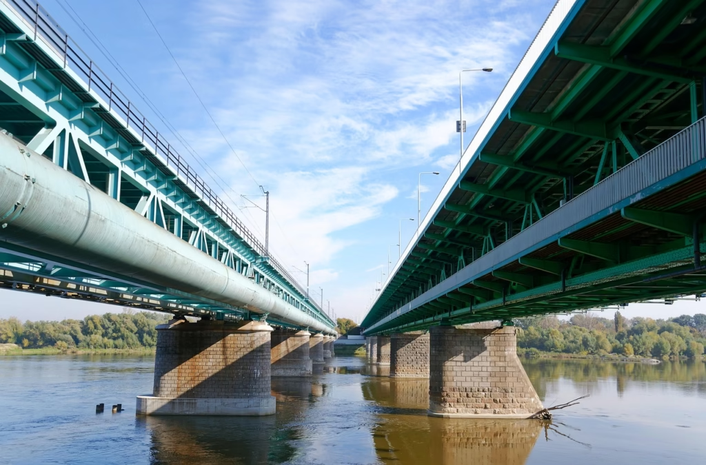
Bridge foundations typically extend all the way down to bedrock to ensure structural stability. Under Japanese engineering standards, this requires drilling holes as deep as five meters into the rock layer. Traditional boring methods remain essential for this deep rock investigation, as no single inspection tool can effectively cover all subsurface conditions, especially in complex rock formations.
The Critical Measurement Gap
Conventional boring investigates subsurface conditions by sampling only about 1% of the ground: taking a 30cm core sample every meter using standard penetration testing, leaving 70cm unsampled between measurement points. This approach creates dangerous blind spots where critical weak layers can exist undetected.
NSWS Precision Investigation Technology Revolution
NSWS revolutionizes subsurface investigation by enabling high-resolution measurements at 1.08cm intervals instead of conventional 1-meter spacing. This 100-fold increase in measurement resolution captures critical details that traditional methods consistently miss. NSWS also provides real-time analysis of soil conditions during investigation.
Challenges in Complex Geological Conditions
The rock domain presents vast complexity that challenges any investigation technology. Rock formations often contain multiple layers with interbedded soil zones that can create failure conditions. These thin soil layers within rock formations are particularly critical for bridge stability but extremely difficult to detect with conventional methods.
Soft Soil Investigation Limitations
In soft soil conditions, conventional sampling often fails because the soil cannot maintain structural integrity during extraction and transport to laboratories. The τ = c + σtanφ calculations require accurate soil parameters, but when soft soil samples become disturbed during handling, the laboratory test results become unreliable.
The 1% Sampling Problem
Traditional soil investigation methods sample only about 1% of subsurface conditions. For every meter of depth, the Standard Penetration Test (SPT) measures resistance (N-value) by driving a rod into the top 30cm, then extracts soil from the lower 70cm with a sampler.
Critical Limitations:
- Soft soils: Too loose to recover intact samples
- Rock formations: Require cutters, may miss thin soil seams
- Hidden weak layers: Soil interlayers within rock cause bridge tilting
- Geological complexity: Rock forms from compressed layers, rarely uniform
NSWS precision investigation technology solves this by measuring continuously at 1.08cm intervals, detecting these hidden risks that conventional methods consistently miss.
Rock itself forms through pressure and heat compressing and transforming stacked geological layers. It’s rare for rock to be entirely uniform. Thin interlayers of soil within otherwise solid rock strata can become critical weak points for infrastructure foundations.
NSWS Advantages in Challenging Conditions
NSWS precision investigation technology addresses these limitations by:
- In-situ measurement eliminating sample disturbance issues
- Continuous profiling detecting thin weak layers within rock formations
- Real-time analysis providing immediate soil characterization
- High-resolution data supporting accurate engineering calculations
Philosophy of Precision Enhancement
The NSWS system is not “a machine that does everything.” Rather, it is a carefully constructed instrumentation system that enables much higher-resolution diagnosis of ground conditions—providing essential input data for the consultants and structural engineers responsible for design decisions.
This precision enables traditional engineering calculations to work reliably by ensuring the input data accurately represents actual site conditions at the scale where problems develop.
Precision Positioning Systems
Every NSWS measurement is precisely located using:
- GPS/GNSS integration for accurate spatial reference
- Survey-grade positioning for millimeter-level accuracy
- 3D coordinate mapping for comprehensive spatial analysis
- Integration with existing infrastructure drawings
Advanced Data Analysis
NSWS technology includes sophisticated interpretation capabilities:
Pattern Recognition Algorithms
- Automatic identification of concerning subsurface patterns
- Comparison with known failure mechanisms
- Early warning system for developing problems
Predictive Modeling
- Projection of subsurface condition evolution
- Assessment of long-term stability trends
- Optimization of intervention timing
Risk Assessment Integration
- Quantification of failure probabilities
- Cost-benefit analysis of intervention options
- Prioritization of maintenance and improvement needs
Applications Across Infrastructure Types
Railway Infrastructure Measurement
Embankment Stability Assessment
- Continuous profiling along track corridors
- Detection of weak layers causing progressive failure
- Identification of groundwater changes affecting stability
- Assessment of loading capacity for increased traffic
Track Foundation Analysis
- Evaluation of ballast and subgrade conditions
- Detection of settlement patterns affecting geometry
- Identification of drainage problems causing deterioration
- Assessment of capacity for high-speed operations
Urban Infrastructure Measurement
Sinkhole Prevention Surveys
- Detection of developing void spaces beneath cities
- Identification of soil erosion around utilities
- Assessment of underground infrastructure condition
- Mapping of subsurface drainage patterns
Building Foundation Assessment
- Non-invasive evaluation of existing foundation systems
- Detection of settlement and stability problems
- Assessment of capacity for building modifications
- Identification of nearby construction impacts
Heritage Site Measurement
Non-Invasive Foundation Assessment
- Evaluation of historic foundation systems without damage
- Detection of deterioration threatening cultural treasures
- Assessment of visitor loading impacts on structures
- Identification of environmental threats to stability
Archaeological Site Investigation
- Subsurface mapping without disturbing archaeological deposits
- Detection of buried structures and features
- Assessment of site stability for preservation planning
- Identification of threats to archaeological resources
Post-Conflict Infrastructure Measurement
War Damage Assessment
- Detection of subsurface damage from explosive impacts
- Identification of weakened foundation systems
- Assessment of infrastructure suitable for immediate use
- Evaluation of reconstruction requirements
Reconstruction Planning Support
- Comprehensive site evaluation for rebuilding projects
- Detection of unexploded ordnance and buried debris
- Assessment of soil conditions for new construction
- Identification of optimal reconstruction strategies
τ = c + σ × tan(φ)
Measurement Advantages Over Conventional Methods
Comprehensive Coverage
Conventional Investigation:
- Point samples every 1-2 meters
- 99% of subsurface conditions unsampled
- Critical weak zones missed between measurement points
- Limited spatial understanding of subsurface conditions
NSWS Technology:
- Continuous measurement along investigation lines
- 100% coverage of investigated profiles
- Detection of all significant subsurface variations
- Comprehensive spatial mapping of conditions
Speed and Efficiency
Conventional Investigation:
- Slow drilling and sampling processes
- Multiple site visits for comprehensive coverage
- Weeks or months for complete assessment
- High mobilization costs for equipment
NSWS Technology:
- Rapid continuous measurement
- Complete profiles in single site visits
- Real-time results enabling immediate decisions
- Efficient mobilization with portable equipment
Non-Destructive Assessment
Conventional Investigation:
- Requires drilling and excavation
- Potential damage to existing infrastructure
- Disruption of site operations
- Restoration costs after investigation
NSWS Technology:
- No excavation or drilling required
- No damage to existing infrastructure
- Minimal disruption to ongoing operations
- No restoration requirements
Cost Effectiveness
Conventional Investigation:
- High per-sample costs
- Limited coverage requires assumption and interpolation
- Multiple investigation phases for adequate coverage
- High costs for accessing difficult locations
NSWS Technology:
- Efficient continuous measurement
- Comprehensive coverage in single investigation
- Complete assessment in single mobilization
- Access to challenging locations with portable equipment

Quality Assurance and Validation
Measurement Accuracy
NSWS technology maintains strict accuracy standards:
- Calibrated instrumentation ensuring reliable measurements
- Quality control procedures validating data accuracy
- Cross-validation techniques confirming interpretation reliability
- Professional certification of investigation procedures
Data Verification
Every NSWS investigation includes verification protocols:
- Multiple measurement techniques providing independent confirmation
- Statistical analysis ensuring data reliability
- Professional review by certified specialists
- Documentation standards enabling independent verification
Traceability and Documentation
NSWS investigations provide complete documentation:
- Detailed measurement logs recording all investigation parameters
- Spatial reference systems enabling precise location verification
- Chain of custody procedures ensuring data integrity
- Professional certification meeting international standards
“This reverence for natural forces guides NSWS methodology—revealing what the Earth actually tells us rather than imposing human assumptions on natural systems.”
Technical Specifications
Measurement Capabilities
Depth Range: Surface to 50+ meters depending on application
Resolution: Sub-centimeter measurement intervals
Accuracy: ±1cm positioning, ±5% measurement values
Coverage: Continuous profiling along investigation lines
Speed: 100-500 meters per day depending on complexity
Environmental Operating Conditions
Temperature: -20°C to +50°C operational range
Weather: All-weather operation capability
Terrain: Adaptable to various ground conditions
Access: Portable equipment for challenging locations
Utilities: Minimal power requirements for field operation
Data Output Formats
Real-time Display: Immediate visualization during investigation
Digital Mapping: GIS-compatible spatial data formats
Engineering Reports: Professional documentation with interpretation
3D Modeling: Subsurface condition visualization
Integration Capability: Compatible with existing design software
Getting Started with NSWS Technology
Assessment and Planning
Initial Consultation
- Discussion of project requirements and challenges
- Evaluation of NSWS technology applicability
- Development of investigation scope and methodology
- Planning of field investigation logistics
Proposal Development
- Detailed scope of work for NSWS investigation
- Timeline and deliverable specifications
- Cost estimation and project scheduling
- Quality assurance and validation procedures
Field Investigation
Site Preparation
- Coordination with project stakeholders
- Safety planning and risk assessment
- Equipment mobilization and setup
- Survey control establishment
Measurement Execution
- Systematic NSWS measurement following planned profiles
- Real-time data quality control and validation
- Adaptive investigation responding to discovered conditions
- Comprehensive documentation of all procedures
Results and Reporting
Data Analysis
- Professional interpretation of measurement results
- Integration with project requirements and design criteria
- Risk assessment and engineering recommendations
- Visualization and 3D modeling of subsurface conditions
Professional Reporting
- Comprehensive technical documentation
- Engineering drawings and spatial mapping
- Risk assessment and recommendation summary
- Integration with project design and construction planning
Why Choose NSWS Precision Investigation Technology
Safety Enhancement
NSWS precision investigation technology prevents disasters by revealing the hidden conditions where infrastructure failures originate. Instead of discovering problems after catastrophic failure, NSWS enables identification and correction years in advance.
Economic Optimization
Comprehensive subsurface understanding enables optimized engineering design and construction planning. NSWS precision investigation technology typically saves 15-30% in construction costs while improving long-term performance.
Risk Mitigation
NSWS precision investigation technology eliminates the subsurface unknowns that create project risks. Comprehensive measurement provides the foundation for confident decision-making and risk management.
Innovation Leadership
Organizations using NSWS precision investigation technology gain competitive advantage through superior subsurface understanding and optimized project outcomes. This leadership position creates business development opportunities and enhanced reputation.
Getting Started with NSWS Precision Investigation Technology
Ready to transform your infrastructure projects with NSWS precision investigation technology?
Technical Consultation Available
Connect with NSWS precision investigation technology specialists to discuss:
- Application to your specific infrastructure type
- Integration with existing investigation and design procedures
- Training opportunities for your technical team
- Partnership possibilities for ongoing projects
Demonstration Projects
For qualified organizations, demonstration projects are available to showcase NSWS precision investigation technology capabilities:
- Pilot investigation on representative infrastructure
- Direct comparison with conventional investigation methods
- Cost-benefit analysis specific to your application
- Training component for your technical staff
The Philosophy Behind NSWS Technology
“Geotechnical engineering is not just about soil and structures — it is about understanding the very structure of the Earth and the universe. Many so-called experts fail because they treat nature as something to control, rather than to listen to. When infrastructure collapses again and again, it is not just a technical failure, but a failure to respect the power of nature.”
— Kozo Okita, NSWS Founder
This philosophy underpins NSWS: a tool not to overpower the Earth, but to reveal what it already knows. Inspired by Japan’s reverence for nature — exemplified in the Shinto tradition and the sun goddess Amaterasu — NSWS technology offers not just precision measurement, but a way of working with the land rather than against it.
Learn More About Infrastructure Safety
Explore our comprehensive Hidden Foundations Series to understand the critical infrastructure safety challenges that NSWS precision investigation technology addresses:
- Railway Safety: How embankment failures cause deadly derailments
- Urban Infrastructure: Why cities face growing sinkhole risks
- Heritage Preservation: Protecting cultural treasures with non-invasive assessment
- Post-Conflict Reconstruction: Safe rebuilding on war-damaged foundations
- Climate Adaptation: Preparing infrastructure for environmental changes
Contact NSWS Precision Investigation Technology Specialists
or fill in the contact form below.

NSWS precision investigation technology is provided through partnership with Technicity international business development. All technical consultation and project implementation is handled by certified NSWS specialists with extensive experience in Japanese precision investigation methodology.
Transform your approach to infrastructure safety through NSWS precision investigation technology that reveals what conventional methods miss.